Every time you check Google Maps for directions, you’re using technology that traces back thousands of years to clay tablets and star observations. The journey from ancient myths carved in stone to satellites orbiting the Earth reveals how humans have always sought to understand their place in the world.
Clay Tablets and Cosmic Centers
The Babylonian Map of the World, created around 700 to 500 B.C., is approximately the size of an early iPhone. It is a clay tablet depicting a circular Babylon at the center, bisected by the Euphrates River and surrounded by an ocean. This wasn’t meant for navigation. It was more primordial: to help the map-holder grasp the idea of the whole world, with himself at the center.
Other early maps served more practical needs, such as the stick and shell charts built to denote currents around islands in the South Pacific over 2,000 years ago, or the Egyptian papyrus maps that led miners through the desert in the 12th century B.C.
When Math Met Geography
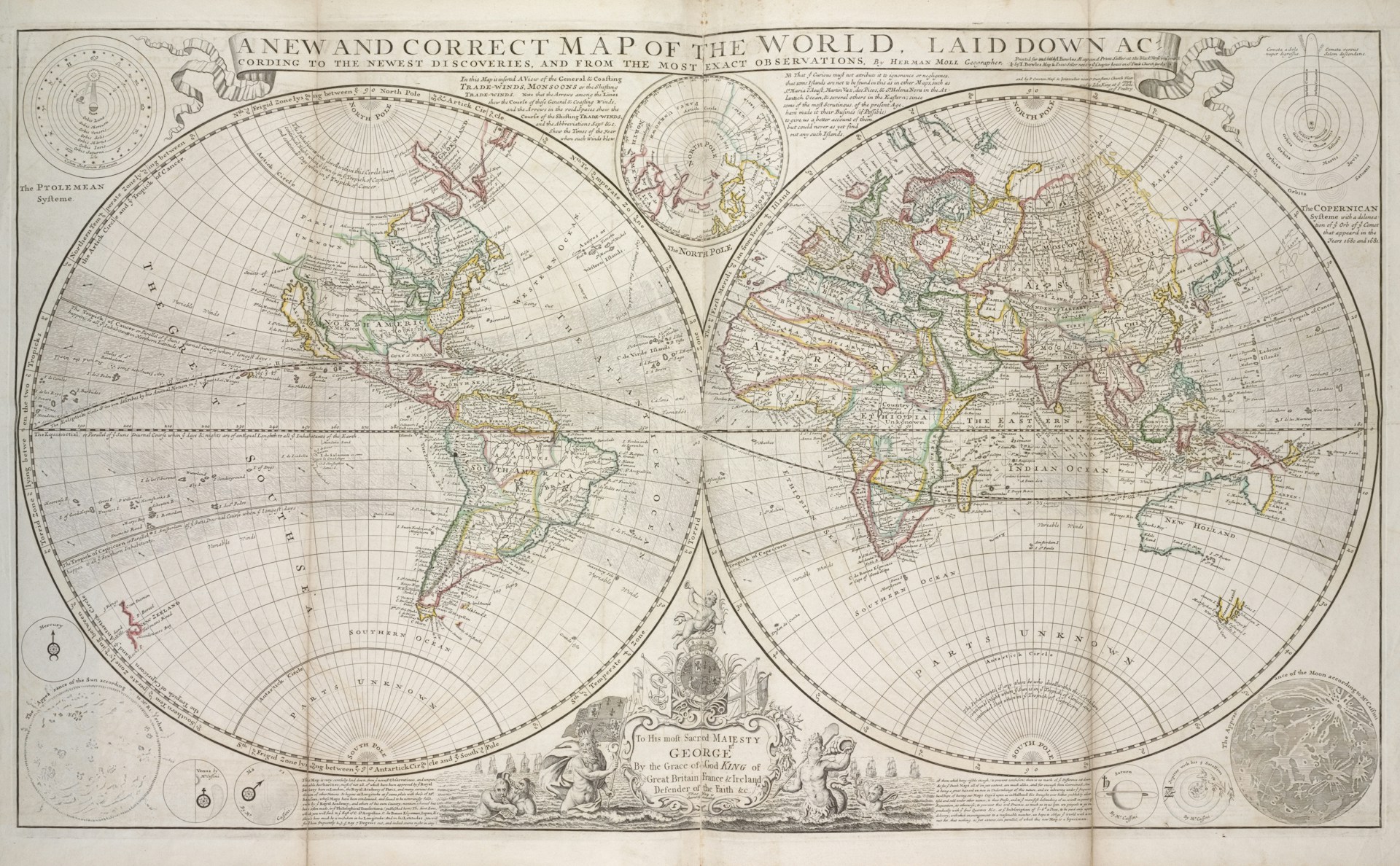
Around 150 A.D., the Greek-Egyptian astronomer Ptolemy compiled the Geographia, an eight-volume atlas that formed the basis for mapmaking for the next 1,500 years. He listed coordinates for 8,000 locations in Eurasia and northern Africa based on parallels of latitude and meridians of longitude, a precursor to today’s system.
Ptolemy was a great scientist who wrote one of the most influential scientific works of all time, The Guide to Geography. This eight-volume work covered the basic principles of map and globe construction, the locations of various cities, mathematical geography theories, and instructions for preparing world maps.
But Ptolemy made costly errors. He thought the world was 30 percent smaller than it actually is, and was using Arabian miles, which were longer than Italian ones. Together, these mistakes led Columbus to believe the voyage to Asia would be much shorter.
Read More: How Old Is the Oldest Living Tree on Earth?
When Maps Became Stories
After the Roman Empire fell, Ptolemy’s realistic geography was lost to the West for almost a thousand years. Once again, maps were concerned more with storytelling. A famous 12th-century map created by Islamic scholar al-Sharif al-Idrisi, commissioned by King Roger II of Sicily, skillfully combined Islamic and Christian cities, while centering the world on Roger’s landholdings.
Christian mappaemundi were designed to illustrate how the story of Christ extended throughout the world. The most famous was made in Hereford, England, a massive 5-by-4-foot creation drawn on a single animal skin where almost none of Europe, Asia, or North Africa is recognizable, and strange wonders run amok.
The Islamic Golden Age Corrections
While science took a sabbatical in most of Europe during the early Middle Ages, al-Idrisi’s work was largely based on Geographia, which was rediscovered and translated into Arabic around the 9th century. Islamic cartographers built on Ptolemy’s work and corrected errors based on their knowledge of the growing empire. They accurately depicted the Indian Ocean as open and connected to the Pacific Ocean, rather than Ptolemy’s landlocked sea.
Read More: The Surprising History of Everyday Inventions That Started as Mistakes
The Age of Exploration and Errors
An early Spanish explorer, possibly confused by the Baja Peninsula, reported in the 16th century that California was surrounded by water on all sides. This error was enshrined by Amsterdam mapmaker Michiel Colijn in 1622, and California was drawn as an island well into the 18th century.
Even professional cartographers made bizarre mistakes. A mountain range depicted near the west coast of Africa was first drawn up in 1798 by British cartographer James Rennell and copied throughout most of the 19th century. Finally, in 1889, a French adventurer went to the region and reported that there were barely any hills there.
From Triangulation to Satellites
The triangulation process enabled distances and elevation to be measured accurately, regardless of their proximity or distance. Advanced forms of the surveying technique enabled the creation of countrywide maps by the end of the 18th century.
GPS was originally designed to track the location of satellites in orbit, which trickled down to track naval ships, aircraft, and eventually for general navigation purposes. High-resolution satellites capable of capturing images at resolutions of less than 1 meter are now commercially available.
The Digital Revolution
With the emergence of new technologies, mapmaking started incorporating the use of computers as an essential tool. It first started out with scanning and digitizing old paper maps, eventually leading to completely digital methods of cartography, where maps could be updated digitally.
Today, technology previously used only in the military, such as GPS and remote sensing from satellites, is now publicly accessible via the internet. The same human drive to understand our place in the world that motivated Babylonian scribes now powers billions of navigation requests daily.
From clay to satellites, maps have always reflected not just geography but human ambition, error, imagination, and our endless need to know where we’re going.
Read More: How Postcards Changed the Way We Traveled